A weighted overlay service is a portal item that references an image service. The image service references a mosaic dataset. In this document, you learn how to share your mosaic dataset as an image service and create portal item. You can share the item with your organization or specific groups. This functionality allows you to share your weighted overlay service with others so that they can leverage your content expertise in an analysis tool.
See Add your data to a mosaic dataset for a description on how to create and configure a mosaic dataset to support a weighted overlay service. Follow the instructions in that document before you continue with the workflow outlined below.
Share your mosaic dataset as an image service
A mosaic dataset is a file-based data storage mechanism. To allow others to use it in a server and cloud environment, share it as a service. To share it as a service, you need an ArcGIS Image Server and an ArcGIS GIS Server with the ArcGIS Spatial Analyst Extension for Server. You can use ArcGIS version 10.3 or greater.
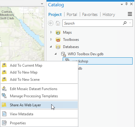
- In ArcMap, navigate to the mosaic dataset you created in Add your data to a mosaic dataset. Right–click the mosaic dataset and choose
Share as Image Service.

- In the Share as Service dialog box, click Next.
- In the Choose a connection drop-down list, choose a connection to an ArcGIS Image Server 10.8.1. Click Next.
- Click Continue.
- In the Service Editor dialog box, click the Item Description link on the left side of the Service Editor and type a summary, tags, and description. In the Tags field, type weightedOverlayService.
- Click the Sharing link on the left side of the Service Editor and check on the groups with which you want to share the service.
- Click Publish.
The mosaic dataset is published as an image service on the ArcGIS Server you specified in step 3. You can browse to the image service details at http://<your server>/arcgis/rest/services. For example, http://your-server:6080/arcgis/rest/services.
Congratulations! You have created and shared a weighted overlay service. You have contributed to a community of online analysis tools. You can discover and use this service in ArcGIS GeoPlanner by clicking Modeler in the Explore segment.